US Utility Potholing provides complete underground utility services across Broward, Miami-Dade, and Palm Beach Counties. From private utility locating and GPR scanning to vacuum excavation, utility potholing, and SUE mapping — we handle the full scope of pre-construction subsurface utility investigation.
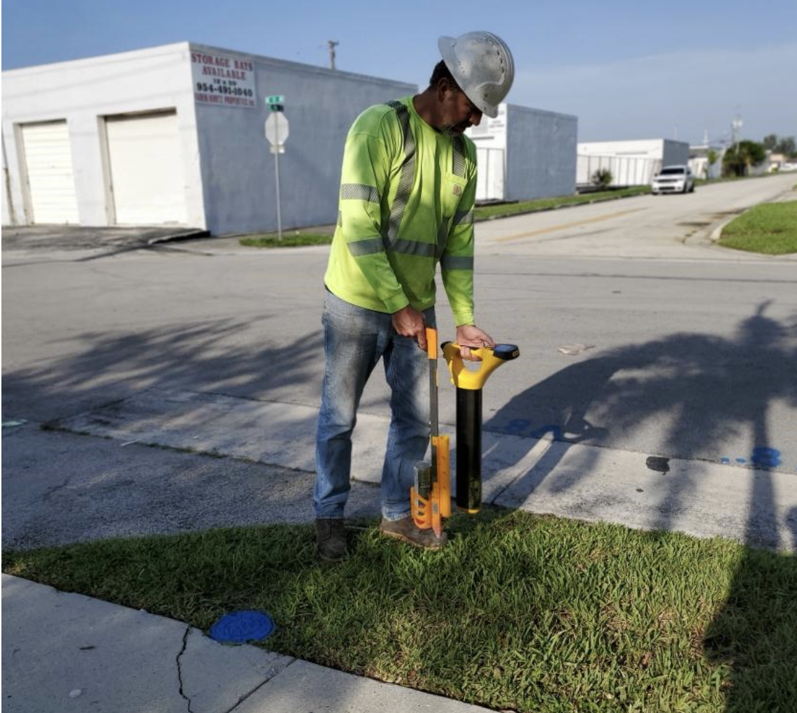
Private utility locating is the foundation of safe excavation on any South Florida construction site. Using professional electromagnetic (EM) detection equipment, our technicians trace underground conductors and pipes across your project area, identifying utilities that 811 will never mark — site electrical conduit, private telecom, irrigation mains, private gas lines, fire suppression water mains, and any other utility installed by a property owner or developer.
Our private utility locating service delivers APWA color-coded field markings and written documentation for every job. We cover the entire project footprint — not just the bore path or trench alignment — to ensure no utility is missed in any area where ground-disturbing work will occur.
Benefits: Prevents utility strikes, protects your crew, keeps your project schedule intact, reduces project liability, and ensures compliance with Florida excavation safety law. Serving Broward, Miami-Dade, and Palm Beach County.
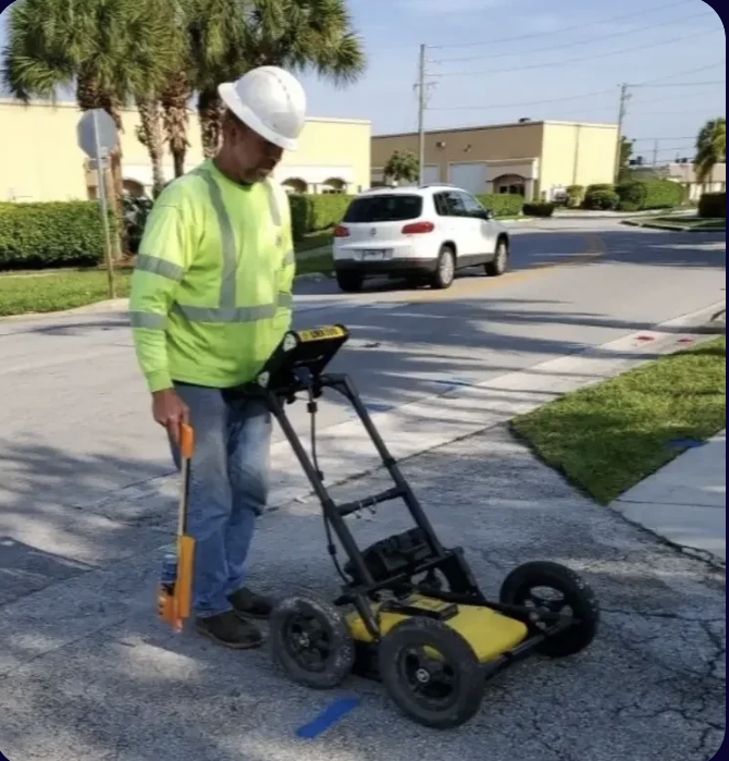
Learn More About Private Utility LocatingGround Penetrating Radar (GPR) scanning detects underground utilities and anomalies that electromagnetic locating cannot find — including non-conductive utilities like HDPE water mains, PVC sewer lines, concrete storm drainage, and abandoned conduit. GPR also detects voids, buried structures, and other subsurface conditions that may affect your excavation or construction plan.
Our GPR scanning service uses professional cart-mounted GPR equipment to sweep your project area in a systematic grid, producing subsurface imagery that experienced technicians interpret and translate into actionable field markings and reports. GPR scanning is commonly used alongside EM locating for complete subsurface coverage, and alone for concrete scanning, slab investigation, and applications where EM is not effective.
Benefits: Detects non-conductive utilities, concrete rebar and post-tension cables, voids and anomalies. Provides the most complete underground picture available without excavation.
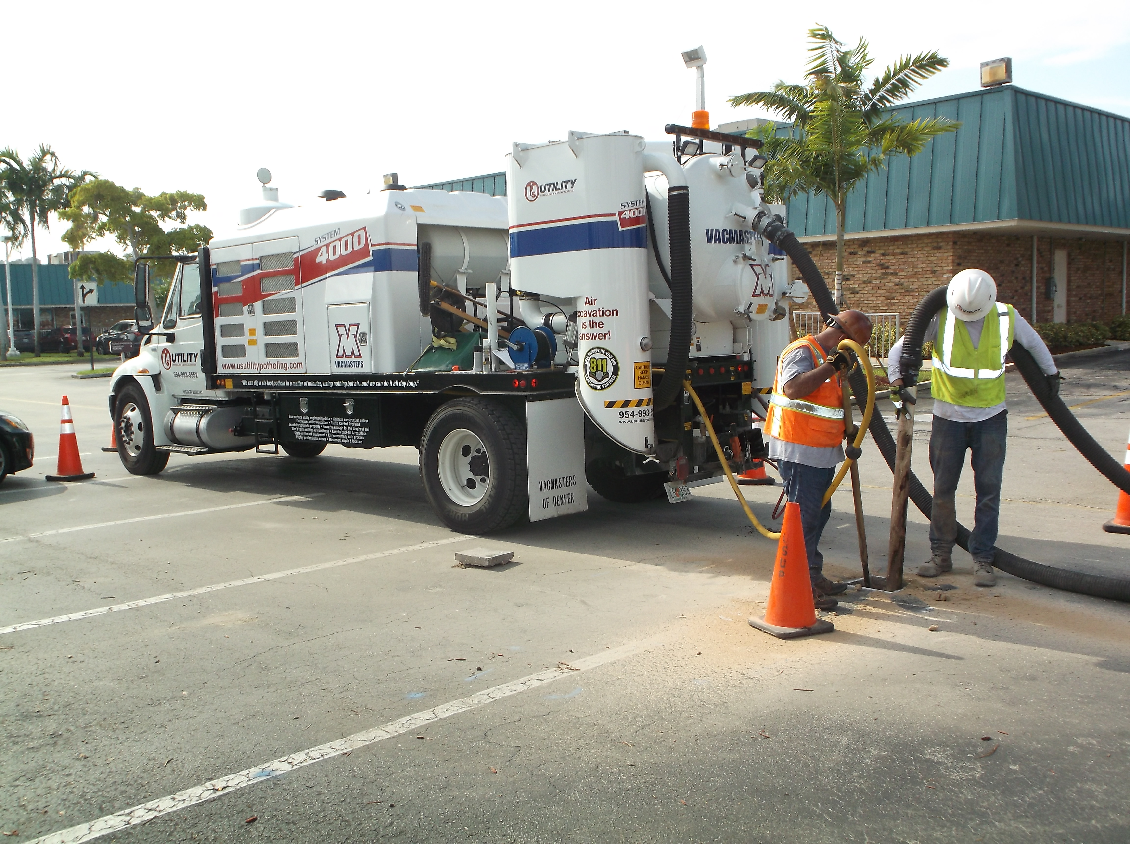
Learn More About GPR ScanningUtility potholing — also called daylighting or test holing — is the process of using vacuum excavation to safely expose underground utilities at specific locations. When locating identifies a potential conflict, or when your project requires the exact depth and position of a utility (not just its approximate surface location), potholing delivers the definitive answer. Using specialized equipment and proven excavation process techniques, our team exposes each utility line while minimizes the risk of damage to active utilities ensuring construction proceeds safely.
Our utility potholing service uses hydrovac or air excavation trucks to create precise test holes that expose the utility without the mechanical impact risk of conventional excavation equipment. We measure and record the depth, photograph the exposed utility, document material and size, and backfill and compact the hole when complete.
Benefits: Provides exact utility depth and position for design conflict analysis, meets ASCE 38-02 Quality Level A requirements for SUE, prevents HDD bore damage, and supports FDOT and municipal project requirements.
Learn More About Utility PotholingVacuum excavation is the broad category of non-destructive excavation that includes utility potholing, soft dig excavation for utility installations, and hydrovac slot trenching. Our vacuum excavation trucks use high-pressure water (hydrovac) or compressed air (air knife) to break up soil, which is then removed by a powerful vacuum into the truck's debris tank — leaving utilities completely unharmed. Our vacuum excavation approach reduces accidental damage to buried utility lines by eliminating the mechanical contact that causes utility strikes, reducing the risk of damaging costly infrastructure.
Our vacuum excavation service is used for utility potholing, slot trenching for new utility installation, exposing utilities in tight quarters where mechanical excavation would be impractical or unsafe, and debris removal from confined spaces. South Florida's high water table and sandy soil conditions are well-suited to hydrovac excavation.
Benefits: Eliminates mechanical damage risk to utilities, works in tight spaces and near existing utilities, handles South Florida's high water table conditions, and can be used for both investigation and installation support.
Learn More About Vacuum ExcavationSubsurface Utility Engineering (SUE) mapping per ASCE 38-02 combines electromagnetic locating (Quality Level B), GPR scanning, and vacuum excavation potholing (Quality Level A) into a comprehensive, georeferenced underground utility record for your project area. SUE mapping is increasingly required for FDOT, municipal, and large private infrastructure projects in South Florida.
Our SUE utility mapping service produces a deliverable that includes all located utility positions, depths from Quality Level A test holes, APWA classification, and attribute data — in a format compatible with your project's GIS or CAD environment. We work with engineering firms and project owners to tailor the mapping deliverable to their specific project requirements.
Benefits: Provides a complete, accurate underground utility record for design, permitting, and construction. Meets FDOT and ASCE 38-02 requirements. Reduces design conflicts and change orders caused by undiscovered utilities during construction.
Learn More About Utility Mapping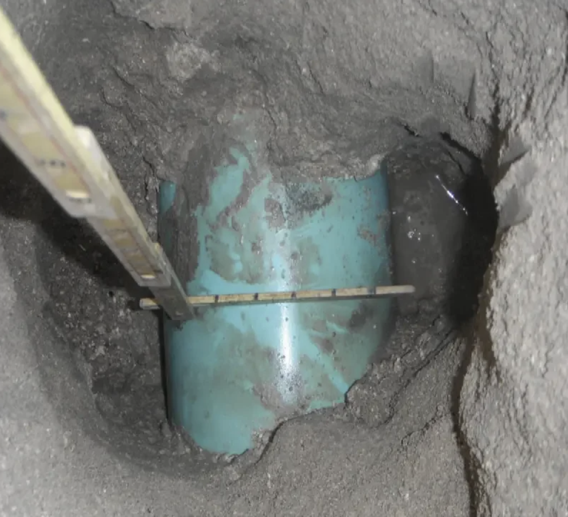
Hydrovac daylighting to physically expose buried utilities to visible depth — required for ASCE 38-02 Quality Level A verification.
Hydrovac services using pressurized water and vacuum to safely excavate around live utilities in South Florida's urban corridors.
Non-destructive soft dig excavation using air or hydrovac methods — the safe alternative to mechanical excavation near utilities.
Full ASCE 38-02 SUE services from QL-D through QL-A for FDOT projects, civil engineers, and infrastructure owners.
Same-day emergency utility exposure for construction holds, active utility conflicts, and urgent pre-bore verification.
Pre-construction utility clearance, potholing for bore path, and conflict investigation for construction projects of all sizes throughout South Florida.
SUE quality level data for design, QL-A potholing for conflict resolution, and utility mapping deliverables compatible with your project's CAD/GIS system.
Private utility locating, SUE mapping, and potholing for FDOT, county, and city public works and capital improvement projects throughout Broward, Miami-Dade, and Palm Beach County.
Site utility clearance before demolition, renovation, or new construction on commercial, industrial, and mixed-use properties. Know what's underground before your crew starts digging.
From utility locating and GPR to potholing and SUE mapping — we cover it all. Free quotes, 2-hour response.