Utility Locating in Coral Springs — A Planned City with Aging Infrastructure
Coral Springs is unique among Broward County cities — it was purpose-built as a planned community beginning in the 1960s, with a coordinated infrastructure grid that gave it a clean start. But that clean start was 50 to 60 years ago. Today, Coral Springs' original utility infrastructure is aging, and much of it was installed in an era before comprehensive utility record-keeping became standard. The result is a city where the utility drawings may exist but are often inaccurate, incomplete, or simply not reflective of decades of modifications, upgrades, and private installations.
For contractors and engineers working in Coral Springs today, that means calling 811 is necessary but not sufficient. Private utilities — including private sanitary laterals, irrigation systems, site electrical for commercial properties along Sample Road and University Drive, and telecom conduit for the city's many office parks — are not covered by 811 and must be located by a licensed private utility locating contractor before excavation begins.
GPR Scanning in Coral Springs
Coral Springs' planned grid layout includes a significant amount of non-metallic underground infrastructure — HDPE water mains, concrete storm drainage, PVC sewer laterals — that electromagnetic locating equipment cannot reliably detect. Ground Penetrating Radar (GPR) fills this gap, providing subsurface imagery that captures both metallic and non-metallic utilities, as well as voids, abandoned conduit, and other underground anomalies.
Our GPR scanning service is particularly valuable for Coral Springs commercial redevelopment projects along the Sample Road (SR-834) and University Drive (SR-817) corridors, where mixed metallic and non-metallic utility systems from multiple eras of development create complex underground environments.
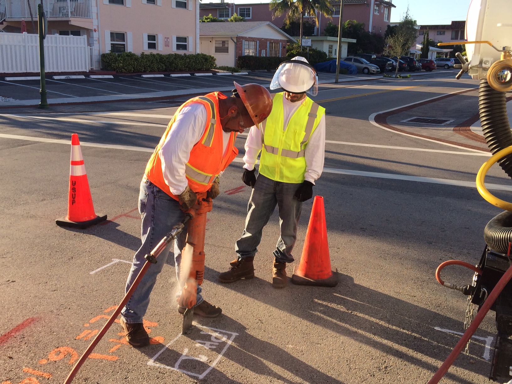
Utility Potholing & Vacuum Excavation in Coral Springs
When your project requires exact utility depths and positions — for design decisions, conflict analysis, or FDOT or municipal compliance — utility potholing provides the definitive answer. Our vacuum excavation trucks safely expose the utility at the precise location, and we measure depth, photograph, and document the result in a format usable by project engineers.
In Coral Springs, we frequently support utility potholing on projects along Wiles Road, Sample Road, University Drive, and the Coral Springs Drive commercial corridor, as well as on residential street improvement and utility upgrade projects managed by the City of Coral Springs Public Works department.
Coral Springs Coverage Area
We serve all of Coral Springs, including the commercial corridors along Sample Road, University Drive, Wiles Road, and Coral Ridge Drive, as well as all of Coral Springs' residential neighborhoods from the city's western edge near the Sawgrass Expressway to the eastern boundary with Margate and Tamarac. We also serve neighboring Coconut Creek, Margate, and the north Broward planned communities that share Coral Springs' infrastructure vintage and challenges.
Frequently Asked Questions — Coral Springs, FL
Why is utility locating especially important in Coral Springs?
Coral Springs was built out rapidly in the 1970s and 1980s as one of Florida's first fully planned communities. This means large amounts of utility infrastructure from that era are now 40–50 years old — past design life for many materials — and much of it lacks current, accurate documentation. Additionally, private utility systems installed for commercial and institutional properties throughout the city are often completely undocumented. Professional private utility locating before any excavation protects your crew, your project schedule, and the city's aging infrastructure.
Do you work on City of Coral Springs municipal projects?
Yes. We support general contractors and engineering firms working on City of Coral Springs capital improvement projects, utility rehabilitation, and right-of-way work. We are familiar with Coral Springs permit requirements for excavation within city rights-of-way and can provide the documentation your project team needs for municipal projects.
How long does a typical Coral Springs utility locating job take?
The duration depends on the project scope. A standard private utility locating sweep of a commercial site in Coral Springs typically takes a few hours. Larger projects covering multiple parcels or extensive right-of-way areas take longer. GPR scanning adds time but significantly improves the completeness of the subsurface picture. We provide project-specific time and cost estimates — contact us at (954) 849-2859 or request a free quote online.